Yosemite National Park is considered one of the crown jewels of the US National Parks System. It contains hundreds of miles of excellent hiking trails, each offering a chance to see one of the stunning features that make this park so unique.
Coming up, we’ll give you the run-down on some of the best hikes in Yosemite National Park, complete with all the information you need to plan your next adventure.
Here are 10 of the best hiking trails in Yosemite National Park.
Upper Yosemite Falls Trail To Yosemite Point
- Length : 9.4 miles
- Difficulty : Hard
- Estimated Time : 6 to 10 hours
- Best Time : June
While you could check out Yosemite Falls from below, the view from the top is hard to beat. This 9.4 mile round-trip hike offers a chance to visit the tallest waterfall in Yosemite National Park for those that are up for the challenge.
Interestingly, this trail is actually one of the oldest in the park, having been built in the mid-1870s. It starts climbing immediately from the trailhead, ascending a seemingly countless series of switchbacks until it reaches an exposed plateau at the top of the falls.
Although many stop their hike at the top of the falls, continuing onward to Yosemite Point is a great choice for those that want one of the best views in the park. From the point, you can see Half Dome, the Lost Arrow Spires, and Eagle Peak, as well as panoramic vistas of the entire valley.
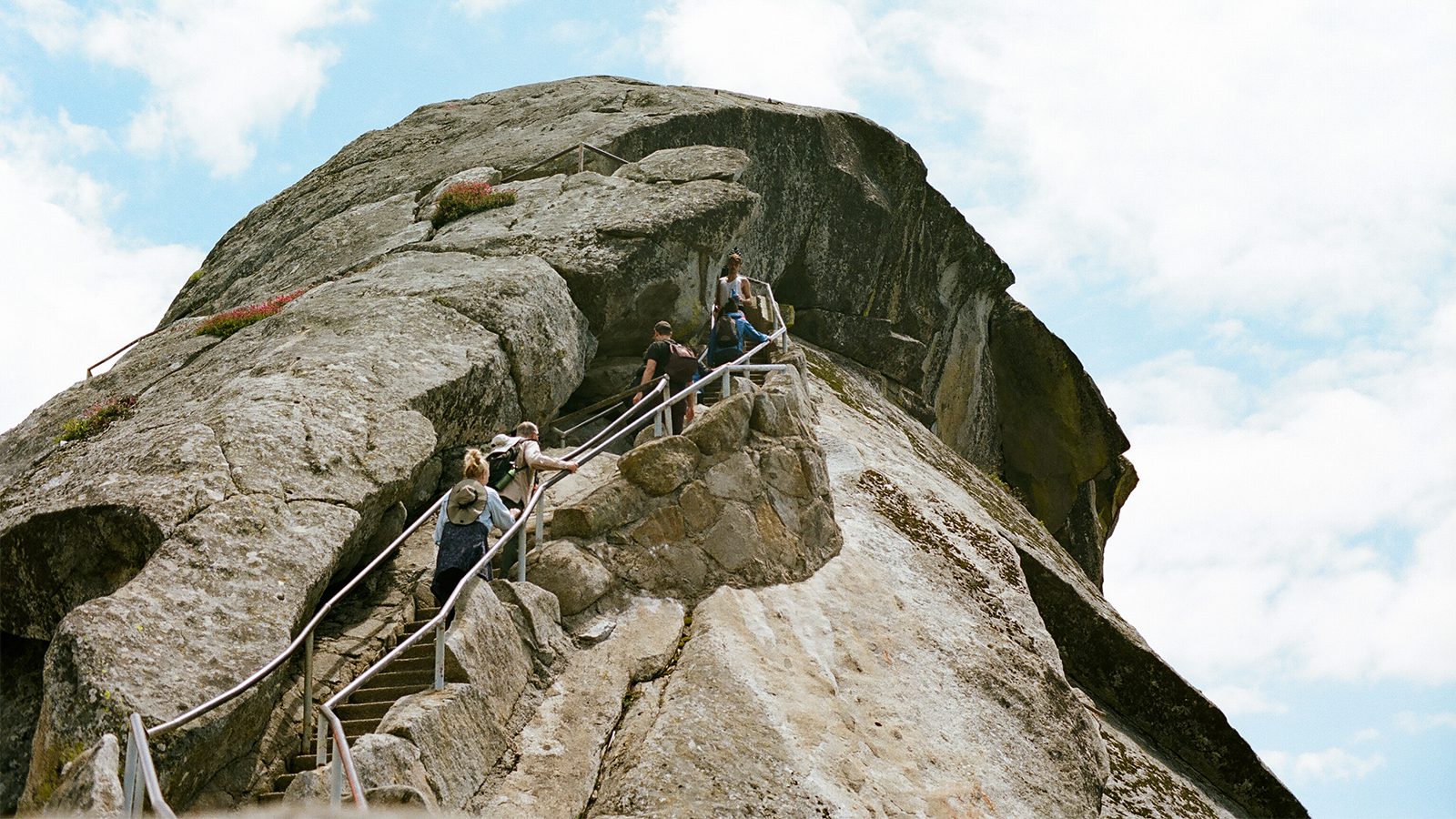
Half Dome Trail (Cables Route)
- Length : 15 miles
- Difficulty : Very hard
- Estimated Time : 10 to 12 hours
- Best Time : September
One of Yosemite’s most iconic geological formations, this strenuous hike to the summit of Half Dome is a must-do for experienced outdoor recreationalists. Most people who complete the hike start from Happy Isles and make their way steadily upward, off the valley floor and to the base of Half Dome.
Along the way, you are treated to great views of Liberty Cap, Nevada Falls, Vernal Falls, and the rest of the High Sierra. Once at the base of Half Dome, you can continue the last 400’ of the ascent up the Cables – a series of metal railings that offer a secure grip over the mountain’s slick granite slabs.
It’s important to note that advanced reservations and permits are required for anyone looking to ascend the Cables Route. Moreover, this hike is strenuous and is very exposed, so it should only be attempted in good weather by experienced hikers.
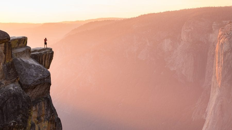
Four Mile Trail to Glacier Point
- Length : 9.6 miles
- Difficulty : Hard
- Estimated Time : 6 to 8 hours
- Best Time : June
Offering some of the best views of Yosemite Falls and the valley below, the Four Mile Trail to Glacier Point is a great option for people who don’t mind a bit of a crowd. The trail starts off at the base of Sentinel Rock and climbs steadily up an old path that was built in the 1870s.
Although the trail has changed a bit over the years, and is now more like 5 miles long, it is still steep and strenuous as it climbs out of the valley floor and up to Glacier Point. At the summit, you’re treated to sweeping vistas of El Capitan, Yosemite Falls, and Half Dome.
If you’re looking for a bit of a side trip, you can also complete a short jaunt over to Union Point during your ascent or you can connect to the Panorama Trail.
Panorama Trail
- Length : 8.5 miles
- Difficulty : Moderately hard
- Estimated Time : 4.5 to 7 hours
- Best Time : June to July
The Panorama Trail is a scenic trek that is most often completed as a thru-hike. Visitors can start either in Yosemite Valley or at Glacier Point, though the Glacier Point route is much more popular because it is nearly completely downhill.
For campers staying in Yosemite Valley, taking the park shuttle to Glacier Point is a good starting point. From there, you get great views of the surrounding region, including the High Sierra, as you descend steadily down to the valley floor.
Anyone looking for more of an adventure can link up the Panorama Trail with the Mist Trail or the Four Mile Trail to create a long day in the mountains.
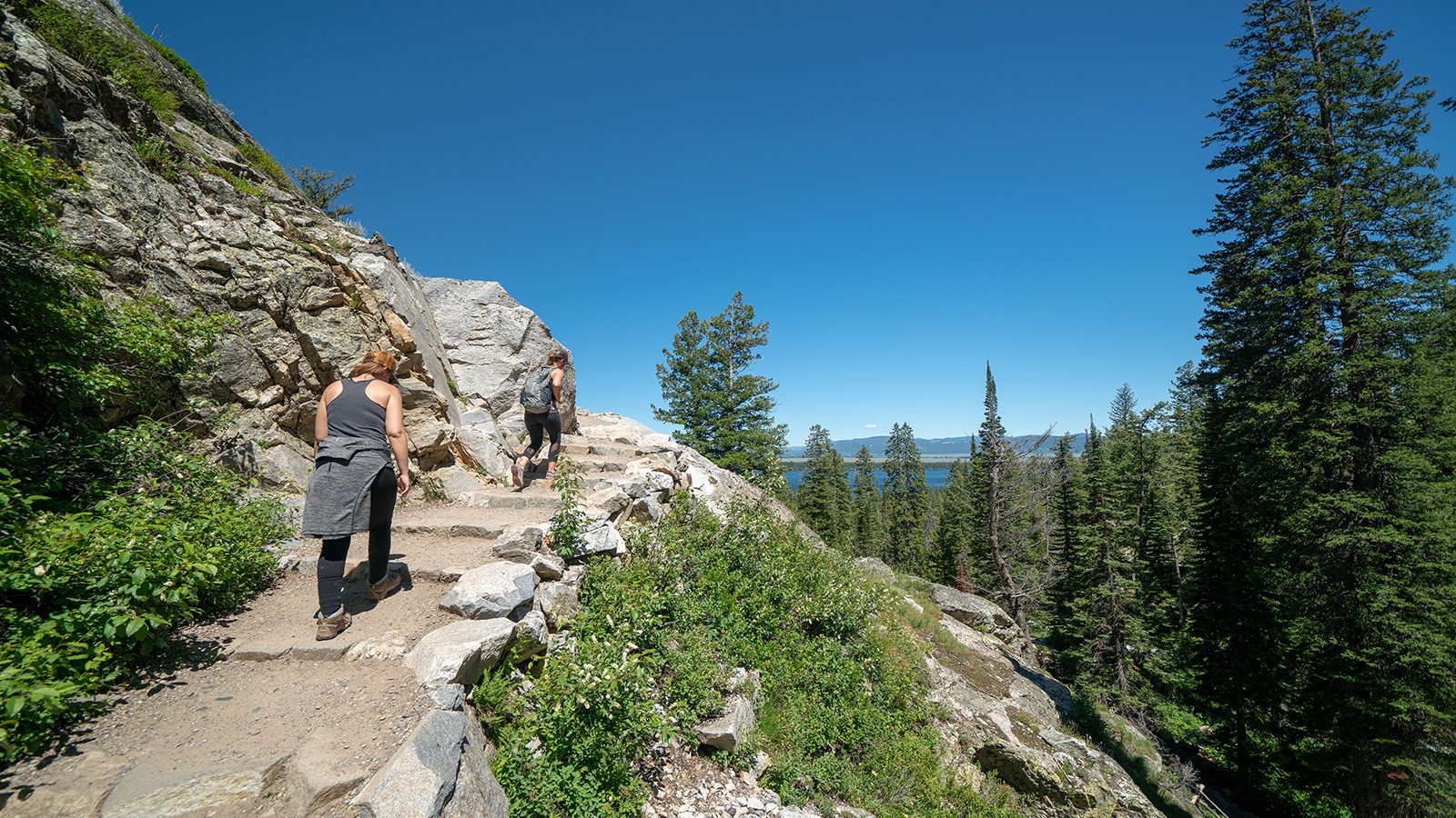
Mist Trail to Vernal and Nevada Falls
- Length : 7 miles
- Difficulty : Moderate
- Estimated Time : 2 to 5 hours
- Best Time : May to June
This trail to see two of Yosemite National Park’s most iconic waterfalls is a must for any visitor. It is often considered the signature hike of the park and can be tailored to meet your specific needs.
The trail starts off at Happy Isles in Yosemite Valley and offers two main destinations: Vernal Falls and Nevada Falls. For hikers that want a shorter hike with a bit of elevation gain, the path to the summit of Vernal Falls is a worthy, 3 mile round trip adventure.
During peak water season (usually May to June), the slightly more strenuous 7 mile round trip hike to the summit of Nevada Falls offers sublime views of both the falls and the surrounding area.
Mariposa Grove Trail to Wawona Point
- Length : 7 miles
- Difficulty : Moderate to hard
- Estimated Time : 4 to 6 hours
- Best Time : September
Featuring staggering giant sequoias and panoramic vistas, the Mariposa Grove Trail to Wawona Point is an excellent option for people looking to venture outside of Yosemite Valley. For anyone coming from the valley, there is a free shuttle to the grove, which is highly recommended as the small parking area at the trailhead tends to fill up quickly.
The trail starts at the Mariposa Grove Arrival Area and steadily gains in elevation as it passes through large stands of giant sequoias. Along the way, hikers get to see well-known trees, such as the Bachelor, the Faithful Couple, the Three Graces, and the Clothespin Tree as they make their way to Wawona Point.
At Wawona Point, you get to experience expansive views of the southernmost parts of the park and the High Sierra.
Cathedral Lakes
- Length : 8 miles
- Difficulty : Moderate
- Estimated Time : 3 to 5 hours
- Best Time : September
Tuolumne Meadows is one of the most scenic sections of Yosemite National Park, but it often goes overlooked when compared to the nearby valley. However, hikers that are willing to make the trek out to the meadows (there’s a free shuttle, by the way!) get a chance to see great High Sierra views and smaller crowds.
The Cathedral Lakes Trail offers a great day hike with a moderate amount of elevation gain as you ascend out of the meadows. During the hike, you get views of stunning granite peaks as you make your way up to Lower Cathedral Lake.
The lake is exceptionally picturesque as it’s surrounded by the jagged Echo and Tresidder Peaks. A short sojourn to the far end of the lake also provides a chance to see Tenaya Lake in the distance.
Bridalveil Falls Trail
- Length : 0.5 miles
- Difficulty : Easy
- Estimated Time : 30 minutes
- Best Time : June
A casual hike out to see one of Yosemite’s raging waterfalls, Bridalveil Falls is a great quick jaunt in the woods.
The trail starts at the Bridalveil Falls Parking Area and follows a wide, paved path to the base of this 620 foot waterfall. During the late spring and early summer the falls are overflowing with water, so be prepared to get wet if you choose to get close to the base.
One thing to note – although the path is paved, it is not considered wheelchair accessible due to its somewhat steep grade. Although some wheelchair users may be able to complete the path, a better paved and well-graded accessible option is the Lower Yosemite Falls Trail.
Sentinel Dome Trail
- Length : 2.2 miles
- Difficulty : Easy to moderate
- Estimated Time : 1 to 2 hours
- Best Time : September
Offering a short hike to a great viewpoint, the Sentinel Dome Trail is an excellent option for anyone looking to get out of Yosemite Valley for a quick jaunt in the alpine.
Starting out at the Taft Point Trailhead, the trail slowly increases in elevation until reaching a lookout at the top of Sentinel Dome. Interestingly, this lookout was also the sight of Ansel Adams’ famous 1940 photograph of a gnarled Jeffrey pine, though the tree died during a drought in the 1970s.
At the summit, you can cast your eyes over panoramic views of Yosemite Valley, the Merced River Canyon, and the High Sierra. On clear days, you can actually see as far west as Mount Diablo in the San Francisco Bay Area.
Rancheria Falls
- Length : 13 miles
- Difficulty : Moderate to hard
- Estimated Time : 5 to 8 hours
- Best Time : June to July or Winter
Perfect for anyone looking to beat the crowds, the Rancheria Fall Trail in the Hetch Hetchy Valley is a great year-round hiking adventure.
Departing from the southwestern part of the Hetch Hetchy Reservoir, this trail walks along the reservoir’s northern shore until reaching a serene waterfall in a stunning backcountry locale. Although the falls don’t plunge hundreds of feet downward like some of the others in the valley, this trail offers peace and quiet that can be hard to get in the more popular areas of the park.
While anyone can drive up to the trailhead for a day hike, a backcountry permit is required for hikers looking to make this an overnight expedition (don’t forget to pack your 2 person tent!).
There Hetch Hetchy Valley has a great network of trails that are less frequently traveled, so Rancheria Falls is a great place to start a longer trip into the Yosemite backcountry.

Gaby Pilson
Gaby is a professional mountain guide with a master’s degree in outdoor education. She works primarily in the polar regions as an expedition guide, though she can be found hiking, climbing, skiing, sailing, or paddling in some of the world’s most amazing places when not at work.