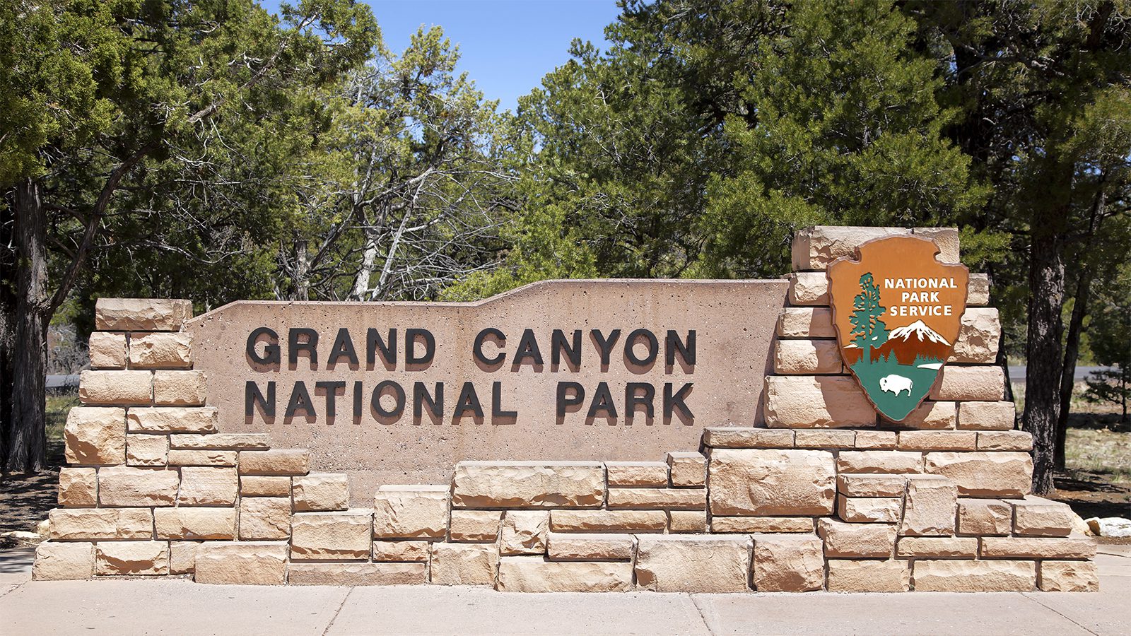
Here are some quick facts about Zion National Park.
- Established : 1919
- Land Size : 2.2 Million Acres
- Annual Visitors : 4.3 million
- State : Utah
- Entrance Fees : $12 per person, $15 per vehicle
More Reading :
Page Contents
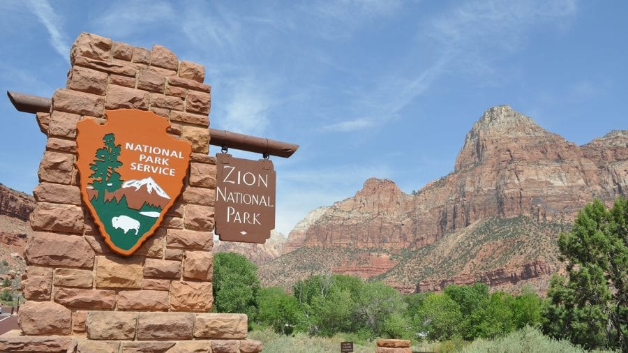
Where is Zion National Park?
Zion National park is located in southwest Utah. Entrances to the park include the south entrance near Springdale, the east entrance along Route 9, and at the Kolob Canyons entrance in the northwest section of the park.
The largest nearby city is Las Vegas, Nevada, which is about 160 miles southwest of the park.
What is Zion National Park Famous For?
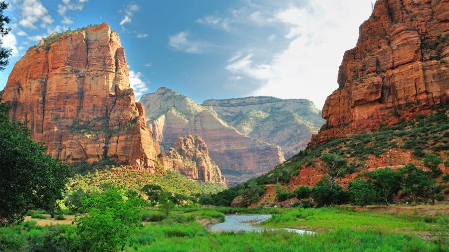
Zion National Park is known for its incredible rock features, high mesas, rocky peaks, and deep canyons.
It’s biggest attraction is Zion Canyon, a canyon carved by the Virgin River that is nearly 15 miles long and more than 2,600-feet deep in some places.
Zion is well-known for its 2,000-foot sandstone cliffs, which are popular with rock climbers. The park features one of the largest free-standing arches in the world and is also world-renowned for canyoneering, a sport that involves descending into narrow canyons through hiking and rappelling.
Other notable attractions include its six-mile long Zion Canyon Scenic Drive, and numerous spectacular hiking trails through its gorges and canyons.
What is the best month to Visit Zion National Park?
The best month to visit Zion National Park is in May.
During May, you’ll enjoy milder weather and smaller crowds. The temperatures are cooler than summer but still warm enough to enjoy all of the park’s attractions with temperatures ranging from the low 50s at night to the low 80s during the daytime.
The park’s free shuttle service opens this month, making transportation much easier than during the off season.
The park becomes green with the arrival of spring, creating a beautiful contrast with the park’s red, pink and cream-colored rocks and wildlife is more active. Rivers and streams are also rushing from spring rainfall.
What to do in Zion National Park?
How many days do I need in Zion National Park?
To fully explore Zion National Park you need at least five days. Although Zion is one of the smaller national parks at 230 square miles, the terrain is rugged, requiring more time to cover all the attractions you should see.
That said, you may not have that much time to spare. Below are two sample itineraries for the park.
Three days (short trip)
Once you arrive at the park, begin your exploration by driving the Zion-Mount Carmel Highway, which is a 10-mile scenic route that runs from CanyonJunction to the Park’s east entrance and afford views of the Great Arch and Checkerboard Mesa and goes through Zion-Mount Carmel Tunnel.
Choose one of the many hikes along this route. ON day two, take a hike on Angels Landing, one of the park’s most thrilling trails, featuring steep cliffs and incredible views.
On day three take the Zion Scenic Drive, which can only be traveled via shuttle from April through October.
Five days (long trip)
After taking in Zion-Mount Carmel Highway, Angel’s Landing and the Zion Scenic Drive on the first three days, continue on with a full-day exploration of Zion Canyon via shuttle. While there, take the short hike to Emerald Pools, Weeping Rock and Riverside Walk.
How to Get to Zion National park?
Flights
If you’re flying to Zion National park, the best way to get there is McCarran International Airport in Las Vegas, followed by Salt Lake City International Airport.
McCarran International Airport (LAS). Located in Las Vegas Nevada, McCarran International Airport is about 170 mile from the park’s south entrance. Airlines servicing the airport include AeroMexico, Alaska, Allegiant, American, Delta, Frontier, Hawaiian, JetBlue, OAI, Southwest, Spirit, Suncountry, United, Viva Aerobus, and Volaris, with non-stop flights from many major cities in all parts of the country. Rental car options include Alamo, Avis, Budget, Sixt, Enterprise, Dollar, Hertz, Thrifty, Payless, and National.
Salt Lake City International Airport (SLC). This major airport is about 300 miles from the park’s north entrance, however, it does offer connecting flights to Saint George Utah, which is about 50 miles from the park and Cedar City, which is only 60 miles from the park. Salt Lake City is served by all major airlines and numerous smaller ones. Numerous rental car companies serve this airport.
St. George Regional Airport (SGU). Located about an hour’s drive southwest of Zion’s Springdale entrance, St. George offers the closest available airport to the park. Airlines servicing the airport include American Airlines, Delta, and United with non-stop flights from Salt Lake City, Phoenix, and Denver. Rental car options include Avis, Budget, Enterprise, National, and Alamo.
Cedar City Regional Airport (CDC). Located about 60 miles from the park, this small regional airport offers service to and from Salt Lake City with four flights daily via Delta Airlines carrier SkyWest airlines. Car rental agencies Avis and Enterprise service this airport.
Drive
If you’re planning to drive from Las Vegas, Salt Lake City or nearby Cedar City and St. George, below are some helpful driving directions:
From Las Vegas, take Interstate 15 north to exit 16. Head east on Route 9 for 33 miles. Continue on route 9 in La Verkin Utah for 20 miles. Continue on Route 9 into the park at the south entrance in Springdale.
From Salt Lake City, take Interstate 15 south to exit 27. Stay left on state highway 17 south for 26 miles. Bare left onto state highway route 9 east in La Verkin for 20 miles. Continue on Route 9 to enter the park at the south entrance in Springdale.
What to See in Zion National Park
Zion Canyon
Take the Zion Canyon Scenic Drive that runs north through the center of the hit national park. This incredible route features massive sandstone formations including the Temple of Sinawava and Great White Throne.
This famous route drops some 2,000 feet over from the East Entrance to the visitors center while passing through the 1.1-mile tunnel through the Zion-Mount Carmel Tunnel, which was built in the 1920s. The road is closed to traffic most of the year for safety reasons, requiring you to take a free shuttle to experience this route.
The Narrows
The skinniest section of Zion Canyon is appropriately called the Narrows and it happens to be one of Zion’s most popular hikes. This is because it offers breathtaking views of the high orange and red canyon walls from the canyon floor. It’s a rare experience for any outdoor enthusiast.
Access the Narrows from the Temple of Sinawava near the Riverside Walk. This easy 1-mile hike offers an excellent view of the Narrows. This footpath eventually turns into a stream, so be prepared to get wet and bring along waterproof shoes.
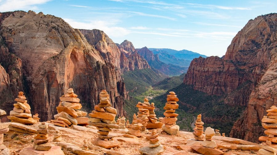
Angels Landing
This is one of the most popular places to visit in Zion despite its difficult and intimidating terrain. Angels Landing Trail takes you to a high lookout with tremendous views of the park’s rugged canyons and mountains.
This trail is no joke with steep climbs, sheer drop-offs and a section that requires you to hold onto chains in order to ascend. This is a true challenge for serious hikers.
Observation Point
This incredible scenic overlook is located more than 6,500 feet above sea level at the top of Mount Baldy. It affords you an incredible view of Zion’s rugged terrain including Angels Landing.
You’ll work for it though, as reaching it requires an 8-mile round trip hike that ascends some 2,000 feet.
Pa’rus Trail
Less a trail and more of a paved greenway for hikers, bikers, and even parents with strollers, this is an excellent way to see Zion National Park without having to take on some of the park’s more challenging and strenuous trails that aren’t suitable for kids.
It’s fairly flat and affords excellent views of the surrounding peaks and terrain while skirting and occasionally crossing over the waters of the Virgin River.
Kolob Canyons
Kolob Canyons is in the northwest corner of the park, putting it out of the way of the park’s main attractions. However, it’s worth the side trip to see it. The Kolob Canyons are part of the park’s Colorado Plateau region and is known for its stunning rock formations.
It offers multiple trails for day hikes or features a park road for a scenic drive that lasts about an hour. Check out Kolob Canyons either on your way into or out of the park.
Checkerboard Mesa
This massive sandstone rock formation features an unusual pattern that looks like a grid, hence the name checkerboard. These strange patterns were created over thousands of years due to high winds and erosion.
There are many hiking trails that afford excellent views of Checkerboard Mesa as well as several pull outs along the highway.

Amanda Williams
Amanda Williams is a writer, plant-nerd, and outdoor enthusiast. She has traveled extensively, around the U.S., throughout Asia, Europe, and Latin America. Everywhere she treks, she takes time to enjoy the outdoors. John Muir is her hero. She aspires to inspire people to live better as he did.